|
   |
|
Page 7 |
Newsletter 115, Winter 2016 © Hampshire Mills Group |
Galway Waterways
Ruth Andrews
|
Galway is
situated on the Corrib River, which flows
from Lough Corrib to the sea at Galway Bay.
The map shows how natural drainage channels
(including the Corrib River, Gaol River, and
Western River) were utilised for the Loughs
Corrib, Mask, and Carra Drainage and
Navigation System, constructed between 1848
and 1858.
The primary
purpose of the system was to improve
drainage (reduce winter water levels and the
areas of flooded land) and navigation in the
respective catchments, and this was to be
undertaken without detrimental effect on the
mills or fishery interests. The winter flood
level was reduced by 450mm (18in) and the
tailraces from the various mills were
deepened such that the water head was not
impaired.
|
| |
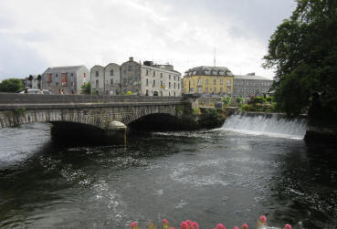
Photo A:
Bridge Mills and River Corrib, with the
outfall from the Western River on the right
|
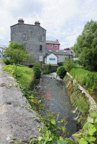
Photo B:
Former flour mill on the Western River, now
a Resource Centre
|
|
The scheme
included the Eglinton Canal, which also
served two main purposes, firstly as a
navigation channel from the Claddagh Basin
to Lough Corrib and secondly as a feeder
channel to the Gaol River and Western River
and the various mills they powered. It was
about three quarters of a mile long,
following a roughly semi-circular course
around the west of the city, bypassing the
main line of the river and many other
watercourses.
By the
mid-19th century the water channels powered
approximately 30 mills, some of which are
marked on the map. The navigation scheme
had a beneficial effect on the mills,
channel dredging had improved their
watercourses, culverts had been improved to
allow tailraces to run under headraces, the
Eastern Conduit had been built, and a new
deep tailrace had been constructed from the
Newcastle Mills to the Marble Factory, and
on to a discharge into the Corrib River.
As early as
1888 a hydropower station was in operation.
The Galway Electric Light Company adapted
the mills at Newtownsmith, and operated
until 1929. |
|
 |
|
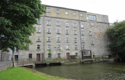
More
recently, University College Galway
purchased a flour mill situated on
Gaol River at Nuns Island (photo C,
left). When the building was being
adapted, sections of a Francis
turbine were discovered; Robert
Craig & Sons of Belfast originally
manufactured this 42kW turbine in
1932, and were able to refurbish it
in 1981. |
|
|
A second
turbine was installed in the mid-1980s.
This was also a Francis turbine but made
entirely of plastic. It operates on a head
of 2m and a discharge of 2.6m3/sec, and it
has a power output of 32kW. |
|
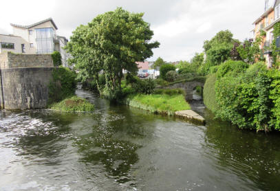
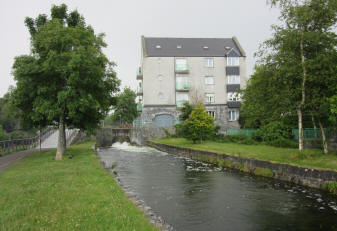
Photo D:
The end of the canal (extreme left)
and 2 tailraces |
The Eglinton
Canal was used until the early part of the
20th century. In 1880 tolls of Ł370 were
collected, but these had reduced to Ł35 by
1905, and Ł1 by 1916. The last boat to use
the canal was a 90ft yacht in 1954. By this
time the swing bridges were in a poor state
and it was decided to replace them with
fixed bridges. |
|
Walking round
Galway today, the many water channels are a
striking feature, but it is quite difficult
to identify some of the mill sites.
Photo D: A
flour and bark mill on the Eastern Conduit,
which was used as a battery charging station
before being converted to apartments |
 |
|
|
|